Hydrographic & Geospatial Support Services
Hydrographic & Geospatial Support Services
- Desktop & Feasibility Studies
We evaluate site suitability, environmental factors, regulatory compliance, and project risks to provide actionable insights for informed planning and decision-making.
- Survey & Data Acquisition
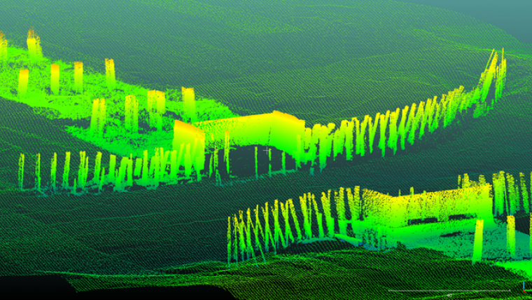
PEAS conducts high-precision hydrographic, geophysical, and topographic surveys using IHO-compliant methodologies and advanced survey equipment to collect reliable bathymetric and geospatial data.
- Data Processing & Analysis
Raw survey data is processed, validated, and transformed into accurate models, charts, and datasets ready for engineering analysis, seabed classification, and project design.
- Data Management & Archiving
We organize, store, and maintain geospatial and survey data using structured systems and metadata frameworks, ensuring integrity, accessibility, and long-term usability.
- Charting & Mapping
PEAS produces precise charts displaying water depths, seabed contours, obstructions, and seabed classifications, supporting navigation, dredging, and offshore construction projects.
- Web-Based Geospatial Visualization
Interactive web mapping platforms allow stakeholders to explore, query, and share project data easily, improving collaboration, transparency, and real-time decision-making.
- Reporting & Documentation
Comprehensive technical reports detail survey methods, results, interpretations, and recommendations, providing authoritative documentation for regulatory, engineering, and project management purposes.
- Client Representation & Coordination
We act as a liaison between stakeholders, contractors, and authorities, ensuring effective communication, smooth project execution, and compliance with technical and contractual requirements.
- Survey & Data Acquisition
PEAS conducts high-precision hydrographic, geophysical, and topographic surveys using IHO-compliant methodologies and advanced survey equipment to collect reliable bathymetric and geospatial data.